Regional overview of the Free State
By John Young
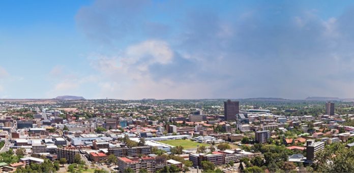
When the leaders of what would become the African National Congress chose a venue for their first-ever conference, Bloemfontein was the natural choice because of the centrality of the town. The city, which has been the judicial capital of South Africa since the creation of the state in 1910, has continued to leverage its central location to become a significant factor in the transport and logistics sector.
The country’s two great highways pass through the province. The N1 provides north-south connectivity and the N3 is South Africa’s busiest road, linking the ports of Richards Bay and Durban with the industrial heartland.
This strategic position lies behind the decision to launch the Maluti-A-Phofung Special Economic Zone on the N3 at Harrismith. Although agriculture and mining remain the mainstays of the provincial economy, diversification and expansion through initiatives such as Special Economic Zones (SEZs) are key to the economic future of the province.
Sectors prioritised at the MAP-SEZ include logistics, ICT, automotive, pharmaceuticals, manufacturing and agri-processing. The 1 000 ha site will has four zones: agri-processing, light industrial, heavy industrials and a container terminal.
Links to the west (Kimberley and on to Namibia) and east (to Lesotho) underpin the planning behind the N8 Corridor concept which covers Bloemfontein, Botshabelo and Thaba Nchu. A plan for the coordinated development of the N8 Corridor has been approved by a range of bodies and is being funded by the Development Bank of Southern Africa (DBSA) and the Mangaung Metropolitan Municipality.

Within this are several projects including the ICC Precinct (hotel and convention centre in Bloemfontein), Bio-Medical Park, Airport Node (logistics and supply chain, warehouses, residential apartments, hospitals, schools, hotels and new shopping malls) and tourism infrastructure for the Naval Hill Development.
Three other national highways intersect the province which is also well served by rail and air links. The Bram Fischer International Airport serves the provincial capital city of Bloemfontein.
Another important new sector is solar energy. The Xhariep, Lejweleputswa and Mangaung regions have among the best direct solar radiation kWh/m² in the country. Only Upington in the Northern Cape has a better solar-radiation index. Rezoning for solar farms has already taken place in several places.

New opportunities are opening up in the gas and energy sectors. Several new licences to explore have been granted and a R200-million helium extraction plant is under construction near Virginia.
Relations have been established with 35 countries with a view to promoting exports. Africa and the BRICS grouping of Brazil, Russia, India and China are focus areas. Other partnerships based on education and trade include countries and regions like Portugal, Turkey and Madeira.
An important pillar of the economy of the Free State, the chemicals and fuels hub at Sasolburg, is modernising and expanding. International fuel, gas and chemicals company Sasol regularly invests in new technologies and in expanding production of its various products.
The Free State shares borders with six other provinces, in addition to the Mountain Kingdom of Lesotho. A summer-rainfall region with a mean annual rainfall of 532mm, the Free State’s climate, soil types and topography vary greatly within the province, with plains in the west and mountains in the east. The western and southern areas are semi-desert, with some Karoo vegetation occurring in the south.
The Free State produces significant proportions of South Africa’s wheat (30%), sunflowers (45%) and maize (45%) and is ranked third in contribution to national GDP in agriculture.

Municipalities in Free State
The Free State has one metropolitan municipality (Mangaung), four district municipalities and 19 local municipalities.
Mangaung Metropolitan Municipality
Mangaung Metropolitan Municipality is a Category A municipality which governs Bloemfontein, Botshabelo and Thaba Nchu. The sixth-largest city in the country, the Mangaung municipal area covers more than 6 263km² and has a population of about 850 000 people. Bloemfontein is responsible for about 25% of provincial GDP.
Xhariep District Municipality
Towns: Trompsberg, Koffiefontein, Zastron, Philipollis, Edenburg, Fauresmith, Smithfield, Wepener
The southernmost region of the Free State is a largely dry area with open grasslands predominating, although it is also home to the Gariep Dam, South Africa’s largest dam. Crops are produced in the northern parts of the district and sheep farming is the biggest activity in the south. Trompsberg has the second-biggest sheep-shearing barn in the country.
Diamonds, gravel and clay are mined at Koffiefontein. Jagersfontein is one of the first places where diamonds were found, and it has its own version of the Big Hole to prove it. The town of Bethulie is a good stopping-over place for tourists wanting to experience the water sports available on the Gariep Dam.
The dam is also the site of small hydro-power and aquaculture projects which are intended to create employment and tackle food security. The nearby Tussen die Riviere Nature Reserve and the Mynhardt Game Reserve have a variety of wildlife in spectacular settings. Jacobsdal’s Landzicht winery has proved itself as a worthy producer of wine. San rock paintings and Anglo-Boer War sites are plentiful.
Lejweleputswa District Municipality
Towns: Welkom, Virginia, Boshof, Christiana, Bultfontein, Bothaville Mining is the most important economic activity in this area, also known as the Free State Goldfields, but it is also the most important maize-growing area in South Africa. A large natural gas field has been discovered on what used to be gold turf. Bothaville is the self-proclaimed Mielie Capital of South Africa but it is a name that is apt. The town hosts the annual NAMPO maize festival and the headquarters of Grain SA.
Mining town Welkom is the major urban centre in the district. The town of Virginia is the site of a jewellery school and it is intended that this will form the nucleus of a jewellery beneficiation hub and an IT hub.
The area has tourist assets such as a holiday resort on the Allemanskraal Dam, the Goldfields Wine Cellar in Theunissen and the Willem Pretorius Game Reserve but there is potential for growth in the heritage sector.
Fezile Dabi District Municipality
Towns: Sasolburg, Parys, Kroonstad, Frankfort, Heilbron, Viljoenskroon The chemical complex at Sasolburg is the economic driver in the district, which shares a border with Gauteng province along the Vaal River. The town of Heilbron is another important industrial centre and Frankfort does important agricultural processing work. Kroonstad is the district’s second-largest town and has a number of engineering works and a railway junction. A new kraft paper factory has been planned for Frankfort.
A good proportion of South Africa’s grain crop is sourced from this district and when the vast fields of sunflowers and cosmos flowers are in bloom, a marvellous vista is created. The Vaal River presents opportunities for yachting, rafting and resort-based enterprises. Parys is a charming town and Vredefort is home to a World Heritage Site, the Vredefort Dome where a meteor crashed to earth.
Fezile Dabi District Municipality is the biggest contributor towards the provincial GDP, contributing approximately 35%. The Fezile Dabi area is mostly dominated by the industrial power of Sasol, with the manufacturing of refined petroleum, coke and chemical products adding largely to its GDP.
Thabo Mofutsanyana District Municipality
Towns: Tweespruit, Ladybrand, Clarens, Harrismith, Vrede, Ficksburg, Phuthaditjhaba, Bethlehem
Tourism and fruit farming are the two principal economic activities of this area which is characterised by beautiful landscapes: the Maluti and the Drakensberg mountain ranges, wetlands in the north, well-watered river valleys and the plains of the north and west. The most famous asset is the Golden Gate National Park.
Industrial activity is undertaken at Harrismith and Phuthaditjhaba, where the Free State Development Corporation is promoting investment. The Maluti-A-Phofung Special Economic Zone (SEZ) at Harrismith is a multi-modal transport and logistics hub.
The commercial centre of the district is Bethlehem while Clarens and Ficksburg have become famous for their artists and cherries respectively. Marquard produces 90% of South Africa’s cherries. The north of the district has many sunflower seed farms. Tweespruit is sunflower seed production centre.


